This mountain bike loop is a moderate ride that takes you through the forests and meadows of the Taceno area. The route starts in the town square in Taceno, near the bus station parking lot. You cross the historic center by bike, passing through the Church of Santa Maria Assunta, and from there you continue along the mule track that starts after the cemetery surrounding the Church and borders the Valle della Madonna Stream until you reach the Church of Santa Caterina in the hamlet of Linate. From this point, turn left and proceed towards Inesio, where you reconnect to the Presallo mule track to return to Taceno. During the route, you face short climbs with some steep sections, but the wooded environment offers suggestive and pleasant views. The descent is more comfortable, with a step-by-step mule track in the first part and then a fast section on mule track and paved road.
Cities crossed by the itinerary
Taceno
Watch the itinerary video
Fotogallery
Point of Interest
Itinerary Data
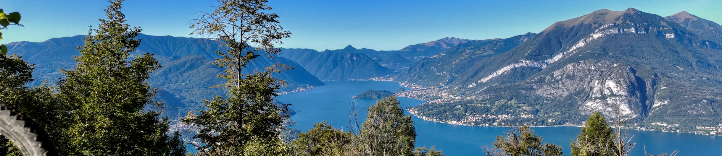
A new cycle network has been created in the Upper Lake Como area. There are 23 routes in two large areas along the lake's shores, for a total of 380 kilometers. Two routes are for beginners, 10 for intermediates, 8 for advanced cyclists, and 3 for experts. The difficulty scale and route tracking were verified by CAI experts, and an international evaluation standard was adopted in agreement with the Lombardy Region.
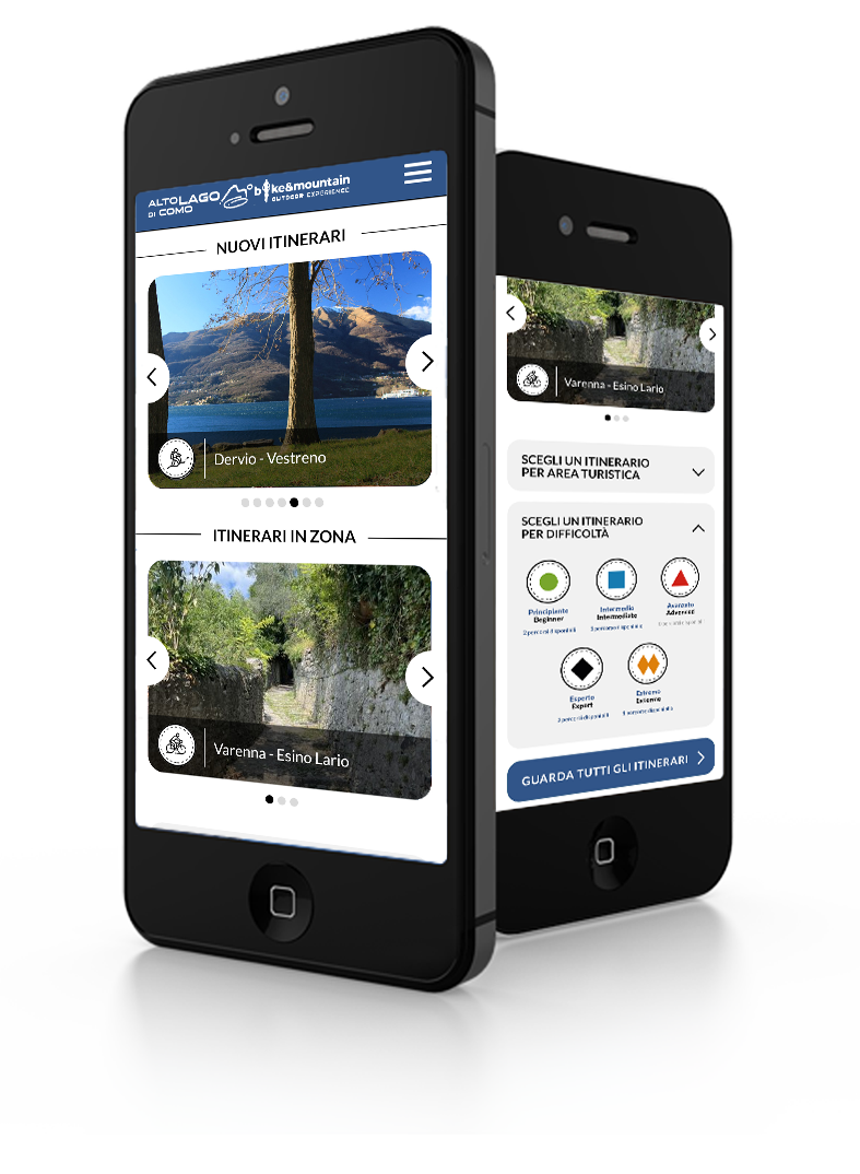
Along the routes, there are many panoramic points where you can admire the stunning beauty of Lake Como. The app provides all the information you need to safely navigate the routes, including directions to equipped areas, places of art and culture to visit, and events scheduled in the towns along the chosen route. You can also watch videos of the best panoramic views.
THE CYCLE ROUTES OF THE WESTERN NORTH LAKE COMO - There are 8 new routes at mid-mountain and high altitude, for a total length of 134 kilometers. The routes connect to existing connections between mountain towns and lakeside towns, where there is already a cycle path. The routes start in Sorico and pass through Montemezzo, Vercana, Trezzone, Livo, Peglio, Dosso del Liro, Gravedona ed Uniti, Stazzona, Dongo, Garzeno, Pianello del Lario, Musso, and end in Cremia.
THE CYCLE ROUTES IN THE VALSASSINA - There are 15 routes that allow you to climb from the lake to the Valsassina and Valvarrone, taking advantage of the trails on Mount Legnoncino; the loop circuits in the North Valsassina; the connections with the Valsassina cycle path; and the routes of the Val d'Esino.
WHAT ARE INTERNAL AREAS AND THE "UPPER LAKE COMO AND VALLI DEL LARIO" STRATEGY? - The "North Lake Como and Valli del Lario" Area Strategy was launched in 2018 as part of the National Strategy for Internal Areas 2014/2020. It involved 31 municipalities in the Valsassina, Valvarrone, Val d'Esino, and Riviera (Lecco) communities and the Valli del Lario and Ceresio communities (Como). The National Strategy for Internal Areas (SNAI) is a strategic plan designed to enhance and develop internal areas, which are often characterized by challenges such as depopulation, lack of services, and fewer economic opportunities. The goal is to promote the sustainable development of these areas by investing in infrastructure, services, the local economy, and the preservation of cultural and natural resources. The "Upper Lake Como and Valli del Lario" Area Strategy, implemented in the period 2018/2023, has made it possible to implement 31 projects for a total of 20 million euros, of which 5,285,000 euroswere used to promote interventions to recover and enhance the heritage and to strengthen the cycle and hiking routes between the lake and the valleys.
WESTERN TRANSOROBICHE - History and stories to reconnect The project revives the ancient routes that once linked the Lecco, Valtellina and Bergamo sides of the Orobic Alps, offering eight hiking and cycle-touring itineraries connected by a main route running from Colico to Lecco. It involves four Mountain Communities across two territorial areas, with trails leading to the fortifications of the Cadorna Line, medieval mines and the ironworking tradition of Valsassina. The aim is to breathe new life into marginal mountain areas by reconnecting communities once bound together by thriving exchanges that have now almost disappeared.
What is a PWA? Progressive Web Apps are a hybrid of mobile app and Web site: it is a technology that runs on the browser and does not require downloads from the app store, which contains Web pages just like a site. Through the install command on the browser you can create a quick link on your smartphone.
Install Bike Valsassina on your device: tap and then Add to homescreen
 7V Taceno-Linate-Presallo