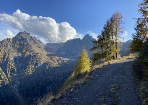


The itinerary develops along the Valtellina side of Monte Rotondo, climbing from Gerola Alta towards Rifugio Alpe Stavello along a network of historic paths, stone-paved mule tracks and agro-silvo-pastoral roads that form the southern access to the Bocchetta di Stavello. This section represents the Valtellina segment of itinerary T.0.3 and is characterised by a harsh alpine environment of great scenic and historical value, with limited cycling suitability, predominantly of an hiking nature.
The route starts in the centre of Gerola Alta, initially following rural roads and pastoral tracks leading towards the higher alpine pastures. The ascent passes through the Castello area and continues in the direction of Laveggiolo, alternating compact dirt sections with older mule tracks, where gradients progressively increase and technical difficulty becomes more pronounced.
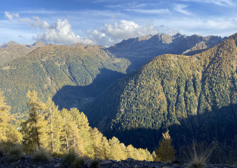
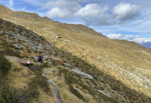
Beyond the Alpe Colombana area, the route takes on a distinctly more alpine and hiking-oriented character. The mule track narrows, the surface becomes increasingly uneven, and stone paving, steps and steep sections appear, significantly limiting rideability and requiring MTB and e-MTB users to push their bikes for extended stretches. The exposure of certain sections and the presence of tight switchbacks demand constant attention and solid experience in alpine terrain.
The climb reaches its conclusion at Rifugio Alpe Stavello (approx. 1,900 m), located in a panoramic position just below the Bocchetta di Stavello. This point represents the natural endpoint of the cycling itinerary from the Valtellina side, as well as an important logistical reference for high-mountain hiking. At the refuge it is possible to stop and, for e-MTB users, carry out an optional battery recharge.
Beyond Rifugio Alpe Stavello, the continuation towards the Bocchetta di Stavello and the ridge dividing the Valvarrone presents characteristics not compatible with continuous MTB use, due to high exposure, steep gradients and the predominantly hiking nature of the trails. This upper section should therefore be considered reserved for hikers, forming a historic and panoramic link with the Lecco side of the massif.